"Mohawk Lake controversy"
- Publication
- Two Row Times (Six Nations of the Grand River, ON), 10 Dec 2014
- Full Text
- Mohawk Lake controversyBy Jim Windle
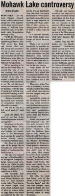
BRANTFORD - Six Nations Elected Council, Brant, and Brantford have pledged to work together on the clean up and repurposing of Mohawk Lake under the name of the Mohawk Lake Remediation Working Group.
The $6-$9 million dollar project kicked off with a gathering of Mayor Chris Friel, Mayor Ron Eddy and Elected Chief Ava Hill, along with members of each of their councils and MPP Dave Levac. A representative of MP Phil McColeman was also in attendance Friday at the Mohawk Park pavilion.
With a painting of the lake in its better days, at around the turn of the last century, the group hopes to restore one of the "jewels" of the city. The project is chaired by Joy O'Donnell, who would like to see the oft discussed restoration become a reality this time with the help of municipal, federal and provincial funding, as well as corporate sponsorship.
The joint project is being touted as an example of cooperation between all parties involved.
"We can do this as a feel good project," said Friel.
Chief Hill added, "It's good to see (us) doing something we can all work on together."
It is all part of the wider ranging Water Front Master Plan, which will also include the remediation of the brownfield lands across the canal on former Massey Harris, Cockshutt, Sternson lands.
But there is a glitch right off the get go. Not at the table are other stakeholders of the lake and the land around it.
The lake was created as a part of the Grand River Navigation Company's barge turnaround area, dug in the 1830's through the middle of the Mohawk Village established by Joseph Brant in 1784.
The Mohawks now occupying the former Kanata Village Museum site have not been included in the talks. They believe the entire Eagles Nest area, which includes most of what is known today as Eagle Place, was never surrendered by the Mohawks. It is on that belief they took over the empty museum site several years ago. Early maps of the area show a large segment of the Mohawk Village under title of John Lovejoy, including some of, but not all of what is today Mohawk Park.
It is situated adjacent to the Glebe lands, also known as Indian Reserve #40B.
There is no record of surrender for transfer to the Lovejoys'. It just suddenly appears as Lovejoy lands around the time the Mohawks were driven from the Village across the river to the Oxbow and, ultimately, to what is now the Six Nations reserve.
Early maps do not line up with what is now Mohawk Park, which the city says was sold to them from the Lovejoy estate by John Lovejoy's son in the late 1800's.
Then there is the Tow Path to consider, a stretch of land on either side of the canal, which oxen used to tow the barges along the canal system.
Against the wishes of the Six Nations' Chiefs of the day, canal investors and the Dominion government paid for its construction and maintenance with money illegally procured from Six Nations' Trust Fund.
When the project fell into financial ruin, the two main investors, William Hamilton Merritt and David Thompson, who built the Ruthven Mansion in York, Ontario, arbitrarily sold their shares to the Six Nations without Six Nations' knowledge, leaving the Six Nations as three-quarters shareholders in a failing enterprise they didn't want in the first place. This money has never been returned to the Trust Fund for Six Nations. When the GRNC finally went broke, the lands used along the canal, including the Two Path, should have been returned to Six Nations, but never were.
But while the canal was being built in the 1830's, it cut through the "Lovejoy lands" and the lake was dredged, separating the lands into two parts, as depicted in the Burwell maps of early Brantford.
Burwell was known as one of the most accurate and detailed survey mapmakers of his time. Archaeologists, even today, are amazed at the accuracy of his maps. But when one compares his maps with later maps, a portion of the Glebe seems to have been absorbed by what later became Mohawk Park.
Either way, the Mohawks, nor the Haudenosaunee Confederacy Chiefs Council have been asked to participate in the Mohawk Park restoration project, despite the fact that there is no legal surrender known for the Lovejoy holdings, and the Six Nations Elected Council was not in existence at the time of the building of the canal, leaving some to think they have no jurisdiction over the former GRNA lands.
- Creator
- Windle, Jim, Author
- Media Type
- Text
- Newspaper
- Item Type
- Clippings
- Publisher
- Two Row Times
- Place of Publication
- Six Nations of the Grand River, ON
- Date of Publication
- 10 Dec 2014
- Subject(s)
- Personal Name(s)
- Friel, Mayor Chris ; Eddy, Mayor Ron ; Hill, Chief Ava ; Levac, Dave ; McColeman, Phil ; O'Donnell, Joy ; Brant, Chief Joseph ; Lovejoy, John ; Merritt, William Hamilton ; Thompson, David.
- Corporate Name(s)
- City of Brantford ; County of Brant ; Six Nations Elected Band Council ; Grand River Navigation Company ; Six Nations Trust Fund ; Haudenosaunee Confederacy Chiefs Council.
- Local identifier
- SNPL004790v00d
- Language of Item
- English
- Geographic Coverage
-
-
Ontario, Canada
Latitude: 43.1668 Longitude: -80.29967
-
- Creative Commons licence
 [more details]
- Copyright Statement
- Public domain: Copyright has expired according to Canadian law. No restrictions on use.
- Copyright Date
- 2014
- Copyright Holder
- Two Row Times
- Contact
- Six Nations Public LibraryEmail:info@snpl.ca
Website:
Agency street/mail address:1679 Chiefswood Rd
PO Box 149
Ohsweken, ON N0A 1M0
519-445-2954


